Download FonixGeo LIME 3.0.1 for Windows
Free download FonixGeo LIME 3.0.1 full version standalone offline installer for Windows PC,
FonixGeo LIME Overview
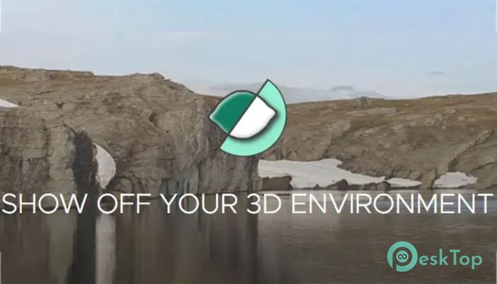
This software brings digital mapping and analysis into your hands with a user-friendly platform focused on interpreting 3D models. Whether you're dealing with photogrammetry, LiDAR scans, or any other 3D measurement method, it provides a smooth experience from model loading to presentation. Developed by Fonix Geoscience, the tool is built on the belief that 3D mapping should be accessible to everyone, no matter your industry or expertise.Features of FonixGeo LIME
Why This Tool Stands Out
One of the strongest points of this application is how it bridges the gap between raw 3D data and interactive experiences. It's not just about loading a model—it's about unlocking stories hidden inside terrain, rocks, or structures. Think of it like turning raw numbers into a digital tour that anyone can explore and learn from.
Easy Model Loading and Cloud Access
You can load models directly into the platform from local files or connect to cloud storage for even more convenience. The tool supports various formats, so you don’t need to worry about compatibility. And if your data lives in the cloud, linking it in takes just a few clicks.
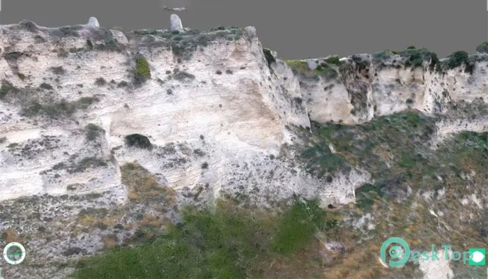
Clear Visualizations That Make an Impact
The strength of any 3D software lies in how well it can visualize data. In this case, it excels by allowing dynamic rendering, realistic lighting, and seamless zooming and panning. You can fly through your 3D world as if you’re exploring it on foot. Everything from terrain shapes to subsurface layers appears vivid and easy to understand.
Powerful Interpretation Tools
You’re not just looking at data—you’re working with it. With built-in interpretation tools, you can highlight areas of interest, draw sections, and mark up the model with notes. It's like having a virtual notepad built right into your field trip.
Smart Panel System
One thing that makes navigation a breeze is the intuitive panel layout. You can toggle panels on or off, dock them where you want, and use them for layers, views, annotations, and more. The clean interface keeps things organized without cluttering your screen.
Seamless Image and Geophysical Integration
Adding geophysical data or high-resolution images to your 3D model? That’s fully supported here. You can blend in seismic lines, georeferenced maps, or drone images with your digital terrain, creating one coherent and interactive canvas for interpretation and presentation.
Work with DEMs Smoothly
If you're working with Digital Elevation Models, the tool handles them like a pro. It allows you to explore terrain elevation data, compare surface changes, or overlay multiple datasets with ease. Perfect for environmental studies, structural geology, and even hydrological mapping.
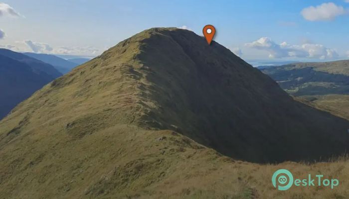
Host Virtual Field Trips
This is where things get exciting. Imagine walking colleagues or students through your model without leaving the office. You can build a virtual field trip using the tool’s built-in features—set stops, guide the camera, add narration, and make learning immersive. This feature is a big win for remote training and presentations.
Who Can Benefit From It?
It’s not just geologists or field workers who’ll love this tool. It's also great for educators, researchers, and planners in the public sector. Civil engineers, environmental consultants, and energy professionals can turn their technical data into something visually compelling and shareable. It opens up new doors for communication and training.
Simple Yet Robust Experience
What makes this software click is its balance between power and simplicity. You don’t need to be a GIS expert to get started. Even with minimal training, most users find themselves confidently exploring and sharing 3D models. And for experts? There's enough depth to get serious analytical work done.
System Requirements and Technical Details
Operating System: Windows 11/10
Processor: Minimum 1 GHz Processor (2.4 GHz recommended)
RAM: 16GB or more recommended)
Free Hard Disk Space: 200MB or more is recommended

-
Program size32.26 MB
-
Version3.0.1
-
Program languagemultilanguage
-
Last updatedBefore 11 Month
-
Downloads24