Download GeoticSection 1.0.13 for Windows
Free download GeoticSection 1.0.13 full version standalone offline installer for Windows PC,
GeoticSection Overview
It is designed to offer a user-friendly and intuitive environment specifically tailored for Windows 10 or higher operating systems. This multilingual software supports French, English, Spanish, and Portuguese languages. It boasts an easy-to-handle interface, allowing users to create sections effortlessly and section books that can be positioned by coordinates or selection.Features of GeoticSection
User-Friendly Interface
It provides an intuitive interface, making it easy for users to navigate and utilize its functionalities efficiently.
Multilingual Support
With support for multiple languages, including French, English, Spanish, and Portuguese, it caters to a diverse user base.
Easy Section Creation
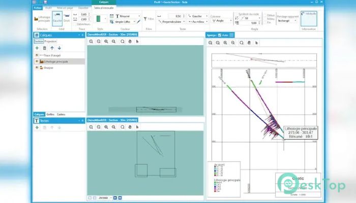
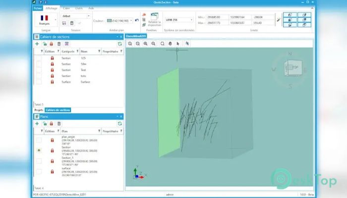
This software simplifies the process of creating sections and section books, offering options for positioning by coordinates or selection.
Graphic Symbols
It includes graphic symbols for various structural elements such as fault, schistosity, joint, etc., enhancing the visualization of geological data.
High-Quality Drawings
Users can expect high-quality drawings, ensuring precision and accuracy in data representation.
Adaptability
Its features can be adapted to meet diverse requirements, offering flexibility in usage.
Drawing Formats
It allows the creation of 3D drawings in VDCL, VDML, DXF, and DWG formats without requiring additional software like AutoCAD or MicroStation. It also supports the creation of 2D drawings in PDF, BMP, JPG, and PNG formats.
Color-Coded Data
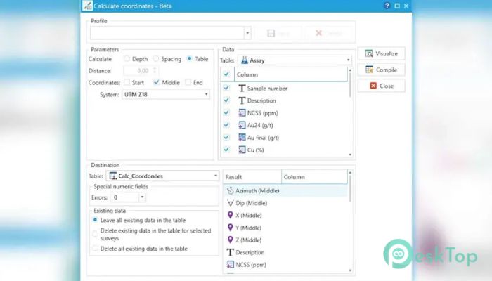
Text and numeric color codes are directly linked to the GeoticLog DB, streamlining data interpretation and analysis.
Graph Inclusion
Users can include graphs for geophysics and assaying purposes, enhancing data visualization and analysis.
Customization Options
It enables creating and customizing legends and title boxes, allowing users to personalize their presentations.
Drilling Core Photo Integration
It offers seamless integration of drilling core photos for comprehensive geological analysis.
3D Drilling Planning
Users can plan 3D drilling with considerations for standard deviation, ensuring accuracy in data collection.
Data Export
The software enables the export of information into CSV or Excel files, facilitating data sharing and analysis.
Data Presentation Control
Users have total control over data presentation, including incorporating bar charts and automatically resizing data blocks.
Survey Visualization
It supports the visualization of all surveys in the Geotic DB, providing a comprehensive view of geological data.
System Requirements and Technical Details
Operating System: Microsoft Windows 10/11
CPU Speed: 1.5 GHz, single-core minimum ~ Recommended: Intel 2.0 GHz dual-core or better
RAM: 2 GB minimum ~ Recommended: 4 GB or more
Display: Dimensions of 1024x768 or more

-
Program size149.74 MB
-
Version1.0.13
-
Program languagemultilanguage
-
Last updatedBefore 1 Year
-
Downloads18