Download Vislog Soil Profile Visualization for Windows
Free download Vislog Soil Profile Visualization full version standalone offline installer for Windows PC,
Vislog Soil Profile Visualization Overview
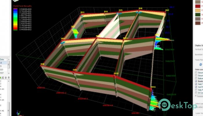
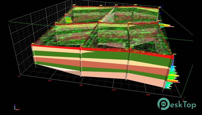
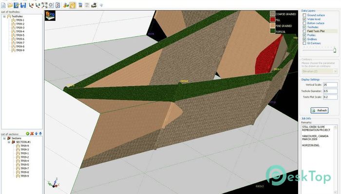
Vislog is an application that can be used for creating 3 Dimensional views of the subsurface layers by entering the borehole data without using any expensive and complicated designing programs. Creating 3 D models for your soil is quite simple. All you have to do is to enter some specifications like borehole data, soil layer and groundwater level plus the coordinates and then leave it to Vislog which will automatically generate a 3D model for you. Vislog Soil Profile Visualization can take the borehole data directly from the giNT files or you can enter them manually as well. After receiving all the required data Visog will instantly generate the model which can be rotated, zoomed in/out and printed as a hard copy. Vislog applies unique shading and colors to all the soil layers and a legend is shown at the top right corner. Different soil groups can be defined by hatching and coloring so that you can differentiate between them easily. The generated models can be exported as an image file or as a video file. You can also export it as AutoCAD DXF file and as a Google Earth model.Features of Vislog Soil Profile Visualization
Can create 3D models of the subsurface layers by entering borehole data.
Simple in its operation.
Need to enter borehole data, groundwater level and coordinates.
Can import borehole data directly from giNT files.
Models can be rotated, zoomed in/out.
Can take the printout of your model.
Can export the model as an AutoCAD DXF file.
Can export the model as a Google Earth model.
Models can be exported as image and video files.
Comments

9.37 MB
Zip password: 123
Program details
-
Program size9.37 MB
-
Version
-
Program languagemultilanguage
-
Last updatedBefore 4 Year
-
Downloads164